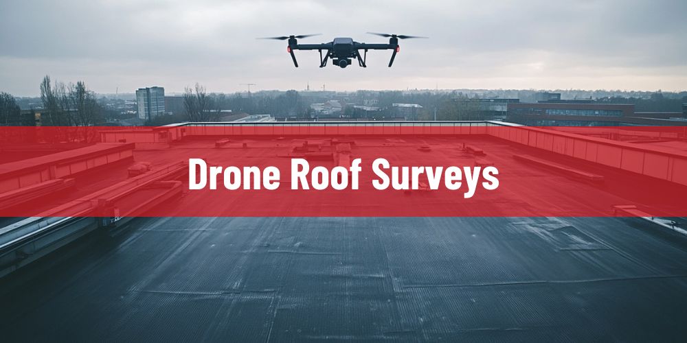
Pinpoint Leak Detection provides drone roof surveys for commercial, industrial, residential-block, education, healthcare, hospitality, retail, logistics, and managed-property buildings across London and the South East. Drone roof surveying sits between safe access planning, roof condition assessment, high-level visual capture, photographic evidence, defect localisation, leak-risk screening, maintenance scoping, and asset reporting, so survey value depends on more than sending a camera above a roof. A properly controlled drone roof survey uses planned flight paths, high-resolution roof imagery, oblique elevation views, close visual passes, roof-area coverage, defect tagging, image-based reporting, and detailed capture of rooflights, gutters, outlets, parapets, flashings, copings, valleys, abutments, penetrations, rooftop plant, membrane laps, pitched roof slopes, inaccessible rear elevations, and hard-to-reach edge details to produce evidence that can support diagnosis, repair planning, insurance records, landlord reporting, and further specialist investigation.
Drone roof surveys in London and the South East operate under access, height, occupancy, and building-density conditions that directly affect how much of a roof can be inspected safely and how reliable the recorded evidence is. Inner London buildings often involve narrow streets, restricted scaffold positions, live shopfronts, occupied offices, schools, apartment blocks, party-wall roof edges, parapet-hidden flat roofs, rear additions, conservation-sensitive elevations, fragile rooflights, plant-congested roof zones, and access routes that are disruptive, expensive, or unsafe for routine inspection. Outer London and South East properties often involve larger warehouse roofs, logistics estates, retail parks, business parks, hotels, care homes, schools, apartment blocks, industrial units, and multi-building sites where roof condition must be reviewed across wide areas without unnecessary access equipment, shutdowns, or intrusive works. In these conditions, drone survey performance is determined by flight suitability, image resolution, roof-area coverage, camera angle, defect visibility, obstruction management, safe operating position, and how clearly the captured evidence connects visible roof condition to leak investigation, roof repairs, moisture mapping, thermal imaging, planned maintenance, or further physical inspection.
- Restricted roof access, height exposure, and fragile roof zones → make ladders, scaffolds, MEWPs, rooflights, wet membranes, steep pitches, parapet edges, service routes, and congested plant areas higher-risk inspection points → roof defects can remain undocumented when assessment depends only on physical access onto the roof surface → missed deterioration, avoidable access costs, delayed leak diagnosis, and unnecessary safety exposure increase when drone inspection is not used as an early evidence-gathering method.
- Large roof footprints and multi-zone commercial layouts → place visual coverage pressure on drainage runs, gutter lines, parapet perimeters, valley channels, rooflight rows, plant decks, membrane laps, service penetrations, extension interfaces, and repeated roof details → isolated ground-level photographs or small-area inspections fail to show how defects relate to roof falls, water movement, access zones, and wider condition patterns → repair scope, maintenance priority, budget planning, and leak-risk interpretation become weaker when aerial roof context is missing.
- Parapet-hidden, rear-facing, upper-level, and obstructed roof sections → conceal slipped coverings, cracked flashings, blocked outlets, open laps, defective sealant, displaced cappings, damaged gutters, corrosion points, ponding zones, moss retention, impact damage, and inaccessible abutments → internal damp symptoms may be investigated without clear visual evidence of the external roof condition above or behind the affected area → recurring leaks, incomplete repairs, repeated callouts, poor contractor instructions, and misdirected remedial work increase when concealed roof areas are not visually captured.
- Insurance, landlord, facilities management, and repair-scoping decisions → require dated photographic evidence, defect location records, roof-area context, access constraints, severity indicators, affected elevations, and clear next-step recommendations → vague inspection notes or disconnected close-up images do not provide enough proof for insurers, freeholders, leaseholders, managing agents, contractors, or maintenance teams → slow approvals, disputed liability, uncertain pricing, fragmented records, and reactive maintenance cycles increase when drone survey evidence is incomplete or poorly structured.
Pinpoint Leak Detection delivers drone roof surveys as a controlled aerial inspection and roof-evidence service, assessing roof type, building height, flight suitability, access limitations, rooflight and edge risk, drainage layout, membrane or covering condition, parapet and gutter details, plant obstruction, visible defect patterns, water-retention areas, image-capture requirements, reporting purpose, and the need for follow-on leak detection, moisture mapping, thermal imaging, physical inspection, repairs, or planned maintenance before defining the most appropriate survey and investigation strategy.
Which Roof Areas Can Pinpoint Leak Detection Survey By Drone?
Pinpoint Leak Detection uses drone roof surveys to capture roof areas where height, access restriction, fragile surfaces, parapet obstruction, plant congestion, tenant occupation, or roof scale makes conventional inspection slower, riskier, or less complete. The survey is not treated as aerial photography alone. It is used to document visible roof condition across access-limited zones, drainage routes, perimeter details, roof penetrations, weathered interfaces, and high-level areas that may influence leak risk, maintenance planning, repair scope, insurance records, or the need for further diagnostic testing.
Across London and the South East, drone survey coverage is especially valuable where roof access is shaped by dense streets, occupied commercial frontages, apartment-block height, school and healthcare safeguarding, restricted service yards, industrial estate roof spans, logistics-building scale, plant-heavy flat roofs, and roof sections hidden from ground level. In these settings, the quality of a drone roof survey is determined by whether the imagery records the roof as a connected asset: how water moves, where details fail, where access is unsafe, and which visible conditions require physical inspection, electronic leak detection, moisture mapping, thermal imaging, minor repair, or planned follow-on works.
- Flat roof membranes and low-slope roof fields → can be surveyed for membrane laps, surface wear, ponding water, impact marks, open joints, failed patches, blistering, staining, vegetation, coating breakdown, drainage restriction, and visible leak-risk indicators → aerial roof-area coverage shows how defects relate to falls, outlets, parapet lines, water-retention zones, and repeated deterioration patterns across the wider roof surface → repair scope, maintenance priority, leak-risk interpretation, and budget planning become stronger when the membrane is recorded as a connected roof field rather than a set of isolated close-up defects.
- Rooflights, kerbs, glazing interfaces, and fragile roof features → create inspection pressure because they combine fall-through risk, upstand detailing, sealant lines, flashing interfaces, glazing frames, condensation marks, dirt retention, and water-shedding edges → drone imagery can document cracked kerbs, failed sealant, staining, debris build-up, displaced trims, damaged flashing, surrounding ponding, and unsafe access conditions without stepping onto fragile areas first → leak investigation, safety planning, and repair sequencing improve when rooflight condition is visually recorded before manual inspection or remedial work is specified.
- Gutters, outlets, scuppers, drainage channels, and parapet drainage routes → can be reviewed for blockages, silt build-up, moss retention, standing water, staining trails, damaged outlet guards, failed gutter joints, overflow risk, downpipe restrictions, and water marks around low points → drainage defects often control where water collects, tracks, backs up, and places pressure on seams, laps, upstands, and internal finishes → water-ingress diagnosis becomes more reliable when drone evidence shows both the drainage component and the surrounding roof area affected by poor discharge.
- Parapets, copings, flashings, abutments, and perimeter edge details → are often difficult to inspect from ground level, scaffold positions, ladders, or the roof surface because their defects sit on high-level, rear-facing, outward-facing, or narrow edge zones → drone capture can record lifted cappings, open coping joints, cracked flashings, failed sealant, weathered mortar, staining, vegetation growth, loose materials, damaged drip edges, and concealed perimeter deterioration → hidden edge defects are less likely to be missed when the roof perimeter is photographed from angles that physical inspection cannot safely or efficiently achieve.
- Rooftop plant zones, service penetrations, cable routes, and equipment supports → place leak pressure on pipe entries, duct openings, cable penetrations, support feet, plant plinths, access walkways, membrane interfaces, coating wear, flashing junctions, and service-maintenance paths → drone surveying can record congestion, standing water, surface scuffing, penetration defects, unsupported services, restricted working areas, and plant-related damage across flat roof service zones → follow-on leak detection, minor repair, contractor access, and planned maintenance can be organised more accurately when plant-related roof risks are visible before attendance.
- Pitched roof slopes, valleys, rear elevations, dormers, high-level junctions, and inaccessible roof sections → can conceal slipped tiles, cracked slates, blocked valleys, moss retention, broken ridge details, defective flashings, damaged abutments, staining, impact damage, and storm-related displacement that may not be visible from street level or internal inspection → drone roof surveys provide high-level visual evidence without immediately requiring scaffold, roof entry, or disruptive access arrangements → inspection decisions become safer and more evidence-led when inaccessible roof sections are captured before leak investigation, repair scoping, or insurance documentation is finalised.
Pinpoint Leak Detection uses drone roof surveys to create a roof-area evidence base across the surfaces, details, edges, drainage routes, plant zones, and inaccessible elevations most likely to affect leak risk, access strategy, repair planning, and maintenance decisions. Where the drone survey records visible defects, drainage concerns, unsafe access zones, weathered interfaces, or signs that concealed moisture may be present, the findings can be used to direct electronic leak detection, roof leak investigation, roof moisture mapping, thermal imaging, physical inspection, on-the-spot minor repair, or arranged follow-on remedial works.
Have a question about leak detection?
What Roof Defects Can a Drone Roof Survey Record?
Pinpoint Leak Detection uses drone roof surveys to record visible roof defects where height, roof geometry, parapet obstruction, fragile construction, restricted access, plant congestion, or building occupation prevents reliable ground-level inspection. A drone survey is not presented as proof of every concealed leak mechanism; it is a high-level visual evidence method used to document surface damage, failed roof details, drainage defects, displaced components, weathering patterns, unsafe access zones, and defect clusters that may explain water ingress, justify repair scoping, support landlord or insurance records, or identify where further diagnostic testing is required.
Across London and the South East, drone-recorded defect evidence is most valuable where building form and commercial use make roof inspection difficult to complete without disruption. Inner London sites often involve live retail frontages, occupied offices, schools, healthcare premises, apartment blocks, roof terraces, narrow rear elevations, party-wall edges, conservation-sensitive rooflines, parapet-hidden flat roofs, and plant-heavy roof zones where visible defects may be present but difficult to reach safely. Outer London and South East properties often involve warehouse roofs, logistics buildings, retail parks, business estates, industrial units, hotels, care homes, schools, residential blocks, and multi-building managed portfolios where defects can repeat across large roof areas, drainage runs, rooflight rows, gutter lines, service routes, and extension interfaces. In these conditions, drone survey value depends on whether the imagery records both the defect and its roof-system context: where it sits, what it affects, how water may move around it, and whether visual evidence is enough or further leak detection is needed.
- Waterproofing membrane defects and roof-surface deterioration → can include split membranes, open laps, lifted seams, failed patches, punctures, blistering, coating wear, surface cracking, impact marks, staining, moss retention, localised ponding, and weathered repair zones across flat and low-slope roof fields → aerial capture shows whether damage is isolated, repeated, drainage-related, foot-traffic-related, or part of wider roof ageing across the membrane surface → repair priority, maintenance planning, and leak-risk interpretation become stronger when membrane defects are photographed in relation to outlets, falls, parapets, plant zones, and adjacent roof condition.
- Drainage defects and water-retention indicators → can include blocked outlets, obstructed scuppers, silted gutters, damaged outlet guards, vegetation build-up, failed gutter joints, low-point ponding, overflow marks, downpipe restrictions, staining trails, debris lines, and water tracking along parapet drainage routes → drone imagery records how water collects, backs up, spreads, and loads vulnerable details rather than treating drainage faults as isolated maintenance items → recurring leaks, saturated roof zones, accelerated membrane ageing, and avoidable emergency callouts become easier to prevent when drainage evidence is captured across the surrounding roof area.
- Rooflight, kerb, glazing, and fragile-detail defects → can be recorded around cracked kerbs, failed sealant, displaced trims, damaged flashing, dirty water marks, condensation staining, loose fixings, deteriorated upstands, cracked glazing interfaces, and ponding around rooflight rows → these details combine leak vulnerability with fall-through risk, so drone capture can document condition before personnel step near fragile roof elements → safety planning, leak investigation, and repair sequencing become more reliable when rooflight defects are evidenced alongside surrounding membrane condition and access risk.
- Parapet, coping, flashing, abutment, and perimeter defects → can include open coping joints, lifted cappings, cracked flashings, failed mortar, loose edge materials, defective drip details, staining, vegetation growth, exposed terminations, weathered upstands, and outward-facing defects hidden from the roof surface → drone viewing angles can record high-level, rear-facing, narrow, or external edge conditions that are difficult to inspect from scaffold, ladders, street level, or normal roof access → perimeter-related water ingress, unsafe edge deterioration, missed repair items, and incomplete survey records are reduced when roof edges are photographed from multiple practical angles.
- Rooftop plant, service penetration, and equipment-zone defects → can occur around pipe entries, duct openings, cable penetrations, plant plinths, support feet, access walkways, flashing collars, coating wear, standing water, service-route scuffing, vibration-affected details, and congested maintenance areas → plant zones concentrate penetrations, maintenance traffic, vibration, drainage obstruction, and waterproofing stress within limited roof areas → follow-on leak detection, minor repair, contractor access, and planned maintenance are easier to organise when drone evidence shows how equipment-related defects connect to the surrounding roof surface.
- Pitched-roof, valley, storm-damage, and inaccessible-elevation defects → can include slipped tiles, cracked slates, broken ridge details, blocked valleys, damaged leadwork, failed abutments, moss retention, staining, wind uplift, impact damage, displaced materials, and debris lodged in roof channels → drone surveys can record high slopes, dormers, rear elevations, party-wall roof sections, and hidden valleys that cannot be assessed properly from street level or internal inspection → scaffold decisions, repair pricing, insurance evidence, and remedial planning become more accurate when inaccessible roof defects are visually documented before physical access is arranged.
Pinpoint Leak Detection uses drone roof survey findings to distinguish visible roof defects from conditions that require further proof. Clear visual damage, blocked drainage, failed perimeter details, unsafe access zones, rooflight defects, plant-zone deterioration, and storm-related displacement can support repair scoping, maintenance planning, landlord reporting, insurance records, and arranged follow-on roof works. Where the suspected issue is concealed beneath the roof surface, hidden within insulation, related to a small membrane breach, or dependent on moisture movement that imagery cannot prove, the drone evidence can direct electronic leak detection, roof leak investigation, roof moisture mapping, thermal imaging, targeted opening-up, physical inspection, on-the-spot minor repair, or planned remedial works.
Want a price for leak detection?
What Prevents a Drone Roof Survey From Producing Reliable Evidence?
A drone roof survey produces reliable evidence only when flight conditions, image capture, roof visibility, access context, and diagnostic purpose are controlled before the survey begins. Pinpoint Leak Detection does not treat drone footage as automatically conclusive. The value of drone evidence depends on whether the survey can clearly record the relevant roof areas, show defects at usable resolution, capture the relationship between visible damage and surrounding roof details, and identify when visual evidence must be supported by electronic leak detection, roof moisture mapping, thermal imaging, physical inspection, or targeted opening-up.
Across London and the South East, evidence quality can be affected by dense streets, restricted take-off positions, live commercial frontages, occupied residential blocks, schools, healthcare sites, roof terraces, party-wall edges, plant-heavy flat roofs, conservation-sensitive elevations, warehouse-scale roof spans, logistics estates, retail parks, industrial units, and multi-building portfolios. In these settings, a drone survey becomes weaker when the imagery records isolated views without roof-area context, when obstruction prevents complete coverage, when weather or lighting reduces detail clarity, or when the suspected defect is concealed below the visible roof surface.
- Poor flight suitability, restricted operating positions, permissions, and access-control limitations → can affect drone survey coverage where narrow streets, courtyards, occupied entrances, public footpaths, service yards, schools, healthcare premises, apartment blocks, roof terraces, neighbouring properties, controlled airspace, overhead obstructions, nearby structures, or congested commercial areas restrict safe, compliant take-off, landing, and flight positioning → the survey may miss relevant roof zones if the drone cannot safely achieve the correct height, angle, distance, line of sight, or operating clearance → incomplete evidence, weak defect records, delayed repair decisions, and the need for additional access methods increase when flight suitability is not assessed before capture.
- Obstructed roof visibility and complex roof geometry → can limit evidence where parapets, plant screens, rooftop equipment, service routes, rooflights, edge walls, stepped roof levels, hidden rear elevations, dormers, valleys, gutters, adjoining buildings, and extension interfaces block the camera’s view of vulnerable details → visual defects may remain unrecorded when the survey captures the roof from too few angles or treats an inaccessible roof area as fully inspected → missed edge failures, unconfirmed drainage issues, hidden penetration defects, and incomplete repair scope increase when obstruction is not built into the survey method.
- Unsuitable weather, lighting, and surface conditions → can reduce image quality where rain, glare, low light, shadow, high wind, standing water, wet reflective membranes, surface contamination, moss, debris, or recent weather events make defects harder to distinguish from normal roof texture → cracking, staining, open laps, failed sealant, ponding marks, gutter blockages, and membrane wear can become unclear if the roof is captured under poor visual conditions → false confidence, ambiguous findings, repeated attendance, and weaker landlord or insurance evidence increase when weather and lighting are not matched to the survey purpose.
- Concealed defects beneath membranes, insulation, overburden, or roof finishes → cannot be proven by drone imagery alone where water is trapped below the surface, insulation is saturated, small membrane punctures are hidden, terrace finishes cover the waterproofing, ballast or green roof layers obstruct the roof surface, or water tracks laterally through the roof build-up → the drone may record surface condition without confirming the hidden water-entry point, moisture extent, or subsurface damage → unresolved leaks, wrong-area repairs, disputed findings, and incomplete diagnosis increase when visual roof evidence is treated as a replacement for moisture mapping, electronic leak detection, thermal imaging, or targeted opening-up.
- Poor image structure, missing roof context, scale uncertainty, and untagged defect evidence → weaken reporting when photographs are not linked to roof zones, elevation positions, drainage routes, parapet edges, plant areas, rooflight rows, defect severity, approximate scale, access constraints, or recommended next actions → even clear images can become difficult to use if they do not show where the defect is located, how large or repeated it is, what roof detail it affects, how water may move around it, or whether further investigation is required → slow approvals, uncertain pricing, fragmented maintenance records, and weak repair instructions increase when drone survey evidence is not organised into a usable roof-condition report.
Pinpoint Leak Detection controls drone roof survey reliability by assessing flight suitability, operating position, roof visibility, obstruction risk, weather conditions, permissions or site restrictions, image-resolution requirements, roof-area coverage, defect-tagging needs, reporting purpose, and diagnostic limitations before relying on aerial evidence. Where drone imagery cannot produce enough proof on its own, the findings can be used to direct physical inspection, electronic leak detection, roof leak investigation, moisture mapping, thermal imaging, on-the-spot minor repair, arranged follow-on repair works, or targeted opening-up so that the final recommendation is based on the right level of evidence.
How Does Pinpoint Leak Detection Carry Out Drone Roof Surveys?
Pinpoint Leak Detection carries out drone roof surveys as a controlled inspection workflow, not as a loose collection of aerial photographs. The process is built around survey purpose, site constraints, safe flight operation, roof-area coverage, defect visibility, image structure, and diagnostic usefulness. Each survey is planned so the captured evidence can support roof condition assessment, leak-risk screening, repair scoping, landlord reporting, insurance records, maintenance planning, or further testing such as electronic leak detection, roof moisture mapping, thermal imaging, physical inspection, or targeted opening-up.
Across London and the South East, the drone survey process must adapt to different operating environments. Inner London surveys may need to account for narrow streets, live commercial frontages, apartment-block height, schools, healthcare premises, roof terraces, party-wall edges, conservation-sensitive elevations, parapet-hidden flat roofs, plant-congested roofs, and restricted take-off positions. Outer London and South East surveys often involve warehouse roofs, logistics sites, business parks, retail units, industrial estates, hotels, care homes, schools, residential blocks, and multi-building portfolios where large roof areas, repeated details, drainage runs, rooftop plant, and access limitations must be captured consistently. In both settings, survey quality depends on how well the inspection method converts site conditions into clear roof evidence.
- Survey objective and site-context review → defines whether the drone roof survey is required for leak-risk screening, visible defect recording, access planning, repair scoping, insurance documentation, landlord evidence, maintenance records, storm-damage review, or follow-on diagnostic planning → the building type, roof layout, access constraints, occupancy, known leak symptoms, internal damp evidence, previous repairs, and reporting purpose are considered before image capture begins → the survey produces stronger evidence when the flight plan is matched to the decision the property owner, managing agent, insurer, contractor, or facilities team needs to make.
- Flight suitability, safe operating position, and obstruction assessment → checks whether the drone can be operated safely around narrow streets, service yards, public edges, neighbouring properties, school or healthcare environments, overhead obstructions, plant screens, parapets, roof terraces, party-wall edges, controlled access areas, and congested commercial sites → flight height, camera angle, line of sight, take-off position, weather conditions, access control, and roof visibility are reviewed before the drone is used → incomplete coverage, unsafe operation, weak imagery, and repeated attendance are reduced when flight suitability is confirmed before survey capture.
- Planned roof-zone image capture → records the roof in structured sections rather than disconnected photographs, covering flat roof fields, pitched slopes, rooflights, gutters, outlets, parapets, copings, flashings, abutments, drainage routes, plant zones, service penetrations, edge details, hidden elevations, valleys, dormers, and inaccessible roof sections → high-level overview images are combined with closer visual passes where access, distance, weather, and visibility allow → roof condition becomes easier to interpret when each defect is photographed in relation to the surrounding roof zone and water-movement context.
- Visible defect recording and roof-system interpretation → focuses on defects such as open laps, membrane splits, failed patches, ponding water, blocked outlets, damaged gutters, cracked flashings, loose cappings, rooflight kerb issues, failed sealant, plant-penetration defects, corrosion, storm displacement, moss retention, surface wear, and previous repair failure → the imagery is reviewed for defect clusters, repeated patterns, drainage influence, access limitations, and whether the visible condition is likely to explain the reported issue → repair priorities and leak-risk decisions become more reliable when photographs are interpreted as roof-system evidence rather than standalone images.
- Evidence organisation, reporting, and diagnostic escalation → converts drone imagery into usable roof evidence by linking photographs to roof zones, defect types, severity, access constraints, drainage behaviour, visible water-retention areas, and recommended next steps → where the drone survey records clear surface defects, the evidence can support maintenance, on-the-spot minor repair, arranged follow-on repairs, insurance records, or landlord reporting; where the suspected issue is concealed, the findings can direct electronic leak detection, roof moisture mapping, thermal imaging, roof leak investigation, physical inspection, or targeted opening-up → decision-making becomes stronger when the survey report separates visual evidence from conditions that need further proof.
Pinpoint Leak Detection carries out drone roof surveys by aligning flight planning, roof-area capture, defect recording, image structure, and diagnostic interpretation with the building’s access conditions and the client’s evidence requirement. This ensures the drone survey functions as a roof inspection and decision-support service, helping establish what can be confirmed visually, what requires closer investigation, and what repair or maintenance route should be considered next.
Why Choose Pinpoint Leak Detection for Drone Roof Surveys?
Pinpoint Leak Detection carries out drone roof surveys as part of a roof diagnostics, leak detection, access-risk, and repair-decision workflow rather than as a generic aerial photography service. The purpose is to produce a defect-tagged roof-zone photographic record that helps property owners, managing agents, landlords, insurers, facilities teams, roofing contractors, and asset managers understand visible roof condition, restricted access areas, drainage behaviour, defect locations, leak-risk indicators, safety constraints, and the next diagnostic or remedial step required. Drone imagery is treated as decision-ready roof evidence: it must show where the defect sits, what roof detail it affects, how surrounding roof conditions may contribute to water ingress, and whether visual evidence is sufficient or further investigation is needed.
Across London and the South East, this evidence-led approach matters because roof survey decisions are often shaped by dense urban access, occupied buildings, live commercial frontages, schools, healthcare premises, apartment blocks, roof terraces, narrow service yards, parapet-hidden flat roofs, fragile rooflights, conservation-sensitive elevations, plant-heavy service zones, warehouse roof spans, logistics-building scale, business estates, retail parks, and multi-building managed portfolios. Pinpoint Leak Detection uses drone roof surveys to reduce uncertainty before physical inspection, on-the-spot minor repair, arranged follow-on repair works, electronic leak detection, roof moisture mapping, thermal imaging, roof leak investigation, targeted opening-up, planned maintenance, refurbishment, or replacement planning is specified.
- Drone survey evidence is interpreted through leak detection expertise → visible roof defects are assessed in relation to internal water-ingress symptoms, drainage behaviour, roof falls, vulnerable junctions, membrane condition, previous repairs, access limitations, and roof-system context → the survey does not stop at image capture when the evidence suggests a hidden leak path, concealed moisture issue, small membrane breach, drainage-related failure, or defect that cannot be confirmed visually → diagnosis, repair scoping, maintenance planning, and evidence quality become stronger when aerial survey findings are reviewed by a roof leak detection specialist rather than treated as general drone imagery.
- Access-risk screening is completed before unnecessary physical inspection is arranged → high roofs, fragile rooflights, wet membranes, parapet edges, steep slopes, hidden rear elevations, plant-congested areas, service routes, narrow courtyards, occupied entrances, and restricted roof zones can be reviewed visually before surveyors, contractors, scaffolding, ladders, or MEWPs are committed → drone capture helps identify which roof areas can be documented from the air, which details require closer inspection, and which access routes may be unsafe or disproportionate → safety exposure, access cost, tenant disruption, scaffold dependency, and avoidable repeat attendance are reduced when roof condition is screened aerially before physical entry is planned.
- Roof-zone photographic records are connected to repair and maintenance decisions → drone imagery can document membrane defects, blocked drainage, ponding areas, failed rooflight details, damaged gutters, parapet deterioration, plant-zone wear, storm displacement, previous repairs, inaccessible elevations, and repeated defect patterns in their wider roof-area context → findings can support on-the-spot minor repairs, arranged follow-on repair works, contractor scoping, planned maintenance, insurance records, landlord reporting, portfolio roof-condition review, or pre-repair evidence where the visible evidence is sufficient → repair decisions become more targeted when the report shows defect location, affected roof detail, approximate scale, surrounding condition, and relationship to drainage or water movement.
- Further diagnostic testing is recommended when visual evidence is not enough → drone surveys cannot confirm every concealed leak source, wet insulation zone, pinhole membrane breach, subsurface moisture path, electrical discontinuity in waterproofing, terrace build-up defect, ballast-covered area, or green roof overburden condition → where aerial imagery identifies risk but not proof, Pinpoint Leak Detection can direct electronic leak detection, roof moisture mapping, thermal imaging, roof leak investigation, controlled hose testing, physical inspection, targeted opening-up, or post-repair verification → false confidence, wrong-area repairs, disputed findings, duplicated attendance, and unresolved water ingress are reduced when drone survey limitations are recognised and escalated through the correct diagnostic method.
- Reports are structured for property, insurance, contractor, and asset-management use → roof photographs are organised around roof zones, defect-tagged image evidence, visible severity, approximate scale, access constraints, drainage context, rooflight and edge risk, plant-area issues, safety considerations, and recommended next actions → evidence can be used by managing agents, landlords, insurers, facilities teams, leaseholders, roofing contractors, asset managers, surveyors, and building owners to approve investigation, price works, document condition, prioritise maintenance, or plan follow-on remedial activity → approvals, repair pricing, maintenance sequencing, insurance review, landlord communication, and long-term roof records become clearer when drone survey findings are presented as usable roof evidence rather than an unstructured image set.
Pinpoint Leak Detection is chosen for drone roof surveys because the service combines aerial access assessment, roof-condition documentation, defect-tagged image reporting, leak-risk interpretation, and diagnostic escalation within one evidence-led process. Where drone imagery confirms visible roof defects, the findings can support maintenance, minor repair, insurance evidence, landlord reporting, contractor scoping, or arranged remedial works. Where the imagery indicates a possible hidden issue, Pinpoint Leak Detection can guide the next step through electronic leak detection, roof leak investigation, roof moisture mapping, thermal imaging, targeted inspection, controlled opening-up, or planned repair works.
When Should a Property Request a Drone Roof Survey?
A property should request a drone roof survey when roof condition needs to be assessed but physical access is difficult, unsafe, disruptive, expensive, or disproportionate to the evidence required. This applies where a building has high roof areas, fragile rooflights, parapet-hidden flat roofs, steep slopes, rear elevations, narrow access routes, restricted service yards, plant-congested roof zones, visible storm damage, blocked outlets, suspected membrane defects, damaged gutters, repeated leaks, insurance evidence needs, landlord reporting requirements, pre-repair documentation, or planned maintenance decisions that require clear roof-zone photographic evidence before scaffolding, MEWPs, intrusive inspection, physical roof entry, or repair works are arranged. For buildings across London and the South East, a drone roof survey is especially useful when occupied premises, live entrances, dense streets, schools, healthcare sites, apartment blocks, retail units, roof terraces, warehouse roofs, logistics buildings, industrial estates, hotels, care homes, business parks, or multi-building managed portfolios require roof evidence with reduced disruption. Pinpoint Leak Detection uses drone roof surveys to establish what can be confirmed visually, which roof areas require closer inspection, where access risk affects the next step, and whether the correct route is on-the-spot minor repair, arranged follow-on works, electronic leak detection, roof leak investigation, roof moisture mapping, thermal imaging, physical inspection, targeted opening-up, planned maintenance, refurbishment, or replacement planning.